Ōtaki Beach coastal hazards
Ōtaki coastal environment
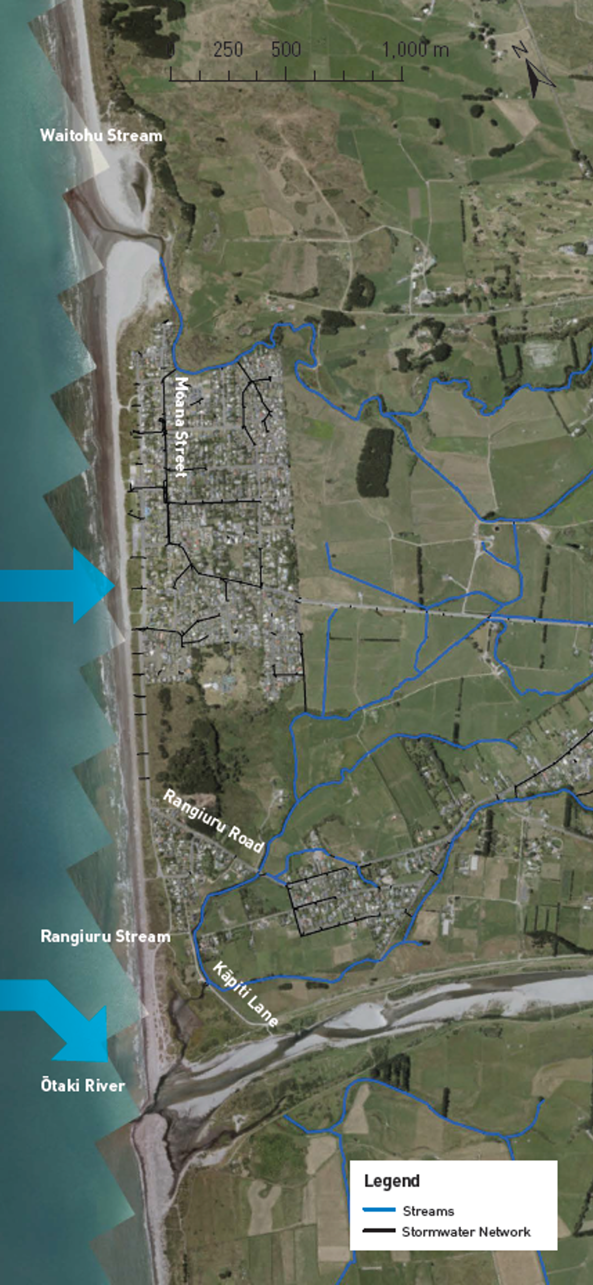
The open coast at Ōtaki Beach is mostly sandy beach (photo A) backed by sand dunes. It also has a small amount of gravels from the Ōtaki River (D). Sand is supplied to this area by the persistent southward longshore transport of sediments from the four large rivers to the north (Whanganui, Whangaehu, Rangitikei and Manawatu Rivers). The supply rate is greater than the transport losses to the south, resulting in long-term shoreline growth. The dunes provide protection to the Ōtaki Beach settlement, acting as a 30–80 m wide buffer between the beach and Marine Parade. The almost continuous dunes and Ōtaki River stopbanks provide good protection from coastal flooding, but there are low areas around accessways where water can run up into the dunes in large events.
Present-day erosion and flood hazards
The present-day erosion hazard is what could occur in an extremely large storm (which has a 1% chance of occurring each year in the immediate/near future). At Ōtaki Beach this is ‘most likely’ be 12–13 m of erosion, with erosion ‘unlikely’ to be more than 19 m.
The areas most susceptible to flooding in this size event are around the lower Waitohu Stream and Rangiuru Stream. The Rangiuru floodgates provide protection from coastal flooding but there is a residual risk of flooding if they fail to close.
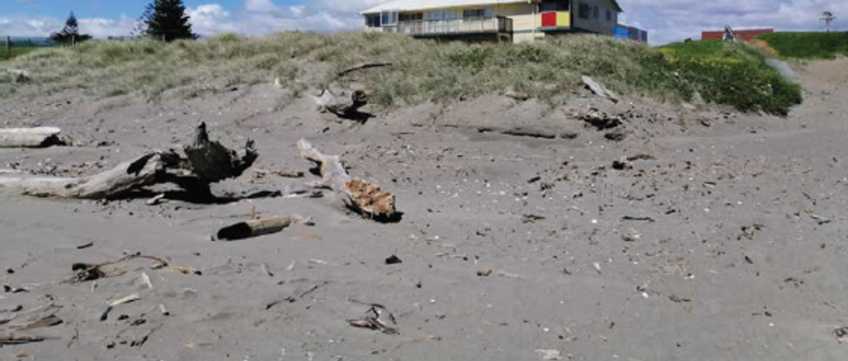) A. Ōtaki Surf Life Saving Club
A. Ōtaki Surf Life Saving Club
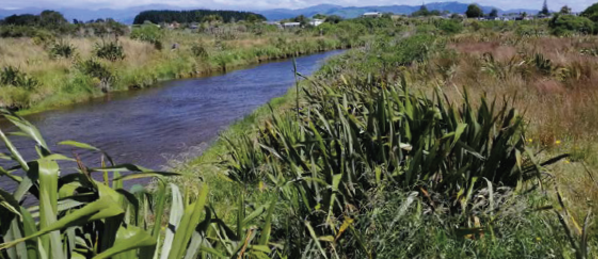) B. Looking upstream of Waitohu Stream into farmland and the back of Ōtaki Beach settlement.
B. Looking upstream of Waitohu Stream into farmland and the back of Ōtaki Beach settlement.
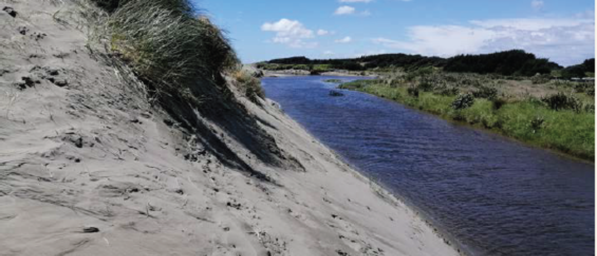) C. Steep sand dunes next to Waitohu Stream.
C. Steep sand dunes next to Waitohu Stream.
The present-day storm-tide level in an extremely large storm is approximately 0.2 m below the lowest ground around the intersection of Marine Parade, Kāpiti Lane, and Atkinson Avenue. The most seaward beach ridge here is susceptible to wave run-up and overtopping. A small area of low-lying land in Caughley Place also lies below the storm-tide level.
Key findings
- The Ōtaki Beach coastline has a good sediment supply that has historically resulted in shoreline growth.
- If this trend continues, only a small amount of erosion associated with extremely large storms is projected to occur over the next 30 years. However, the shoreline is projected to erode over the next 30–100 years.
- For coastal flooding, the Ōtaki Beach settlement is generally well protected by sand dunes and the Rangiuru floodgates but is susceptible to flooding through pathways up the Waitohu and Rangiuru Streams.
- Under higher RSLR scenarios, Ōtaki Beach land parcels become progressively more susceptible to flooding, and for the highest RSLR scenario the main evacuation route becomes vulnerable to flooding.
Future coastal erosion hazard
The shoreline at Ōtaki Beach has good sediment supply, which is projected to continue. As a result, it is projected that over the next 30 years erosion is likely to be limited to small distances, similar to the present-day hazard in an extremely large storm. However, with higher RSLR scenarios over the next 50 to 100 years, the shoreline is projected to erode. The following erosion distances are averages from the upper bound of the 'most likely' erosion position.
Ōtaki Beach
Projected to erode:
- 13 m by 2050
- 14 to 22 m by 2070
- 22 to 55 m by 2130
Future coastal flood hazard
The main flooding pathways are the Rangiuru and Waitohu Streams, and a low point in the dunes at the southern end of Marine Parade. While the Ōtaki River (photo D) provides a path for coastal flooding, the stopbanks either side of the river are well above present-day storm tide levels.
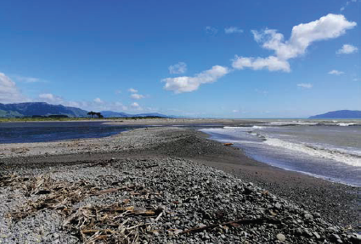) D. Ōtaki River mouth
D. Ōtaki River mouth
)
0.35 m and 0.45 m RSLR (~2070)
The area susceptible to inundation around the Waitohu and Rangiuru Streams increases in these scenarios. Largest areas of potential flooding are generally around Rangiuru Road and Moana Street.
0.85 m and 1.25 m RSLR (~2130)
The areas susceptible to flooding around the Waitohu and Rangiuru Streams both increase in size. The Moana Street area is susceptible to direct flooding from the Waitohu Stream. The Rangiuru Stream catchment is susceptible to flooding from the sea over low points in the Ōtaki River stopbank at the outfall to the stream over Kāpiti Lane, Rangiuru Road, and around the back of the Ōtaki Beach settlement.
Asset exposure
Ōtaki Beach has low vulnerability to coastal erosion compared to other areas of the district.
Marine Parade is unlikely to be affected by erosion over the next 30 years but could be impacted over 50–100 years. Up to 14 to 39 private land parcels could be affected by erosion under the highest RSLR scenario in 50 years. This increases to 39 private land parcels under the highest RSLR scenario in 100 years.
In terms of flooding, as RSLR increases, the area susceptible to flooding in extremely large storms is projected to increase from being localised around the Ōtaki River to affecting many private land parcels in the Ōtaki Beach settlement. It will also see extensive flooding in the flat farmland behind the settlement. The two main evacuation routes for Ōtaki Beach will also become increasingly susceptible to flooding in extremely large storms with RSLR.
How these hazards have been assessed for Ōtaki
Coastal science experts from Jacobs assessed the susceptibility of coastal erosion and flooding hazards and the exposure or vulnerability of land parcels and infrastructure (e.g. roads, bridges, three water assets) to these hazards across the entire Kāpiti District.
Government guidance recommends that for detailed hazard and risk assessment in both coastal and non-coastal areas, councils should assess the SSP2-4.5 ‘middle of the road’ climate change scenario, and higher SSP5-8.5 ‘fossil fuel intensive’ climate change scenario.
Coastal erosion
The components used to calculate a potential coastal erosion distance along the Ōtaki coastline include:
- the natural long-term trend of the shoreline movement (ie, eroding, growing, or stable)
- the amount of erosion which could occur as a direct result of the rise in sea levels compared to land level (termed the Relative Sea Level Rise (RSLR)) over timeframes of 30, 50, and 100 years
- short-term storm erosion from an extremely large storm which has approximately a 1% chance of occurring in each year, based on observations from the September 1976 storm, and
- erosion from dunes restabilising to their natural stable slope following a large storm
Jacobs used a ‘probabilistic approach’ to tie likelihoods to the erosion distances calculated for each scenario of RSLR. The ‘most likely’ range of shoreline positions has a 33–66% chance of occurring. The ‘unlikely’ shoreline position is where there is a 10% chance that the erosion would reach or be greater than this position.
Coastal flooding
To assess the coastal flood hazard for Ōtaki Beach Jacobs mapped the area which is susceptible to flooding by a large storm tide which has a 1% chance of occurring in any year. The maps show the flooding that could occur at the present time and in the future, for RSLR scenarios of +0.2m; +0.35m; +0.45m; +0.85, and +1.25m. Jacobs used a simple ‘bathtub’ approach, where all land below the storm tide water level is mapped as susceptible to flooding, regardless of connection to the sea. The maps also show areas which could be affected by additional flooding due to wave run-up overtopping the dunes.
- Ōtaki Coastal Hazards factsheet [PDF 667 KB]