Paraparaumu coastal hazards
Paraparaumu coastal environment
The Paraparaumu coast consists of a sandy beach backed by dunes. The shoreline extends west from the rest of the Kāpiti Coast shoreline in a large delta shape due to Kāpiti Island reducing wave energy and promoting greater shoreline growth over the Holocene period (i.e. last 10,000 years). This growth now acts as a natural barrier which traps longshore sand coming from the north and reduces the amount of sediment that travels past to the southern parts of the district. Periodically storms attack the dunes (photo B) and cause them to erode landward. However, good sediment supply to the area means they can usually recover from these episodic events. The dunes along the front of Paraparaumu also provide good flood protection from waves, but the land elevation reduces through the residential area nearing the Waikanae Estuary.
Present-day erosion and flood hazards
The present-day erosion hazard is what could occur in an extremely large storm (which has a 1% chance of occurring each year in the immediate/ near future). In Paraparaumu this is ‘most likely’ to be around 8 m of erosion, and unlikely to be more than 10 m.
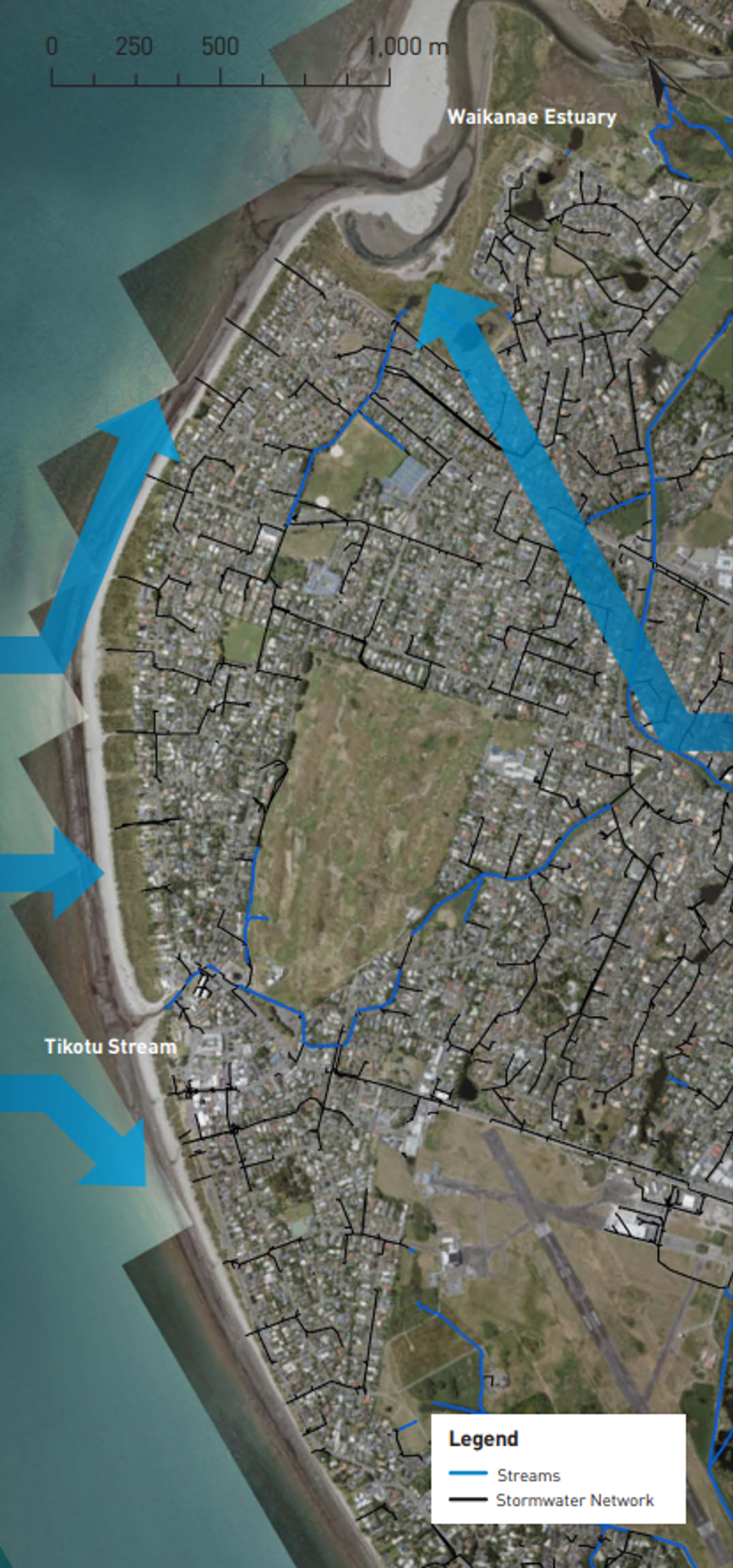
For coastal flooding, in the same sized storm, present-day hazards are localised around Tikotu Stream and the wetlands next to the Waikanae Estuary, including land around the Mazengarb Stream at Makora Road.
Key findings
- The Paraparaumu shoreline is projected to have future erosion issues at the southern end of Marine Parade and directly south of the Waikanae River in the next 30–100 years.
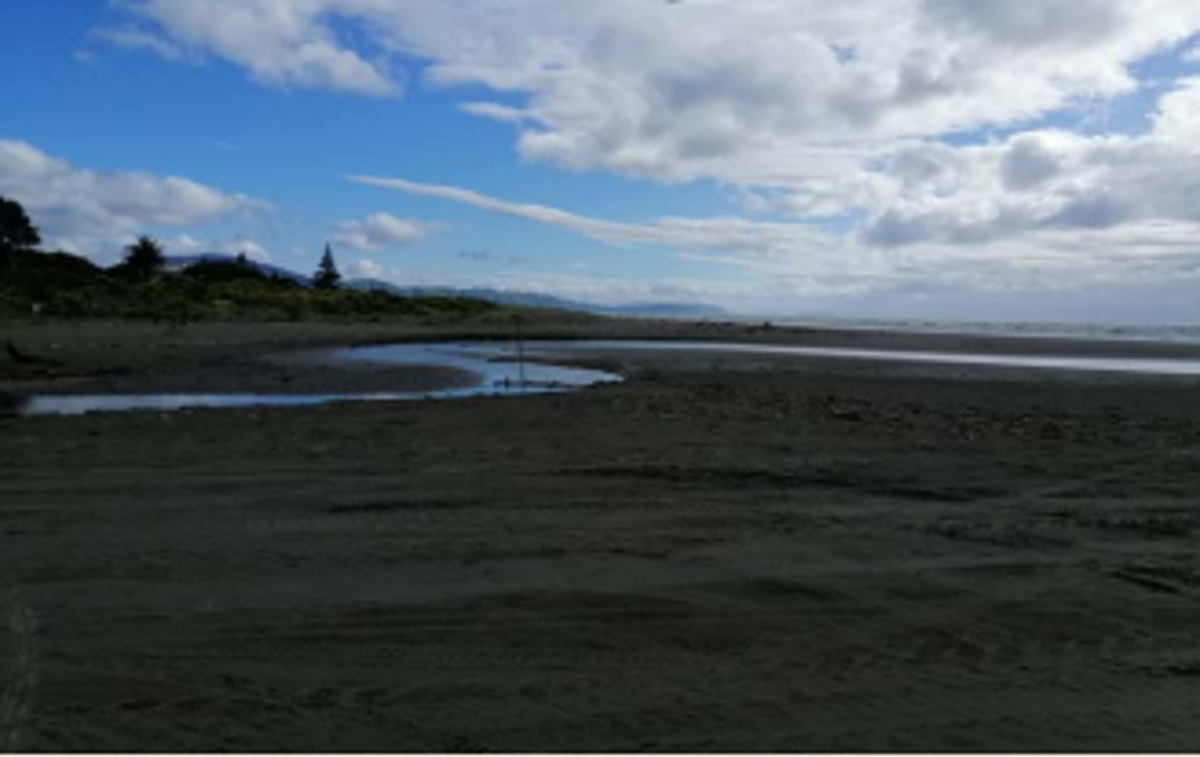 A. Tikotu Stream
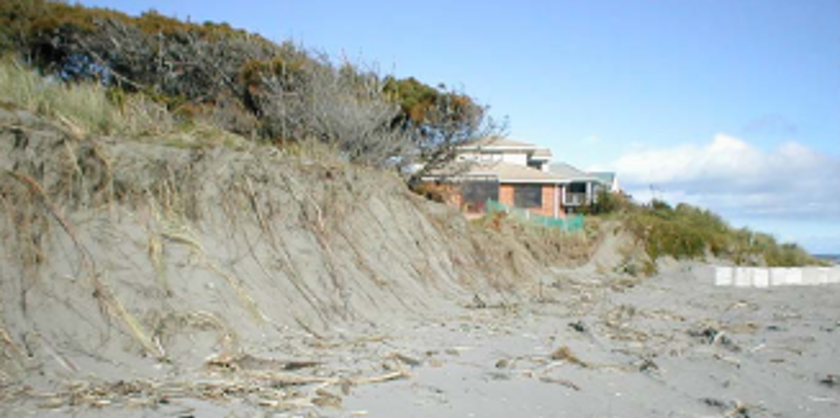 B. Dune scarp erosion in 2003 at the northern end of Manly Street
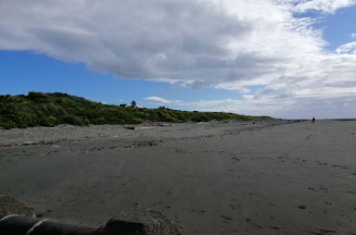 C. Wide flat sand beach with vegetated dunes in front of Manly Street by Ngapotiki Street.
- Throughout the central area of Paraparaumu, north of the Tikotu Stream, the shoreline is projected to continue to grow in the future.
- Coastal flood hazard increases with relative sea level rise (RSLR) in the low-lying areas south of the Waikanae Estuary and around connecting drains and tributaries. The area susceptible to flooding becomes extensive under the highest RSLR scenario in 100 years.
Future coastal erosion hazard
The central part of the Paraparaumu shoreline is projected to continue to grow in the future, regardless of the level of RSLR. However, areas of shoreline to the south of the Waikanae Estuary and to the south of Tikotu Stream at either end of the continued accumulation area are projected to erode in most RSLR scenarios in the future. The following erosion distances are averages from the upper bound of the ‘most likely’ erosion position.
North Paraparaumu
Projected to erode on average:
- -18m by 2050
- -26 to -30m by 2070
- -50 to -66m by 2130
Central Paraparaumu
Projected to grow:
- +18m by 2050
- +30 to +34m by 2070
- +62 to +81m by 2130
South Paraparaumu
Projected to change:
- -3m by 2050
- -1 to -6m by 2070
- -20 to +3m by 2130
Where ‘+’ = growth and ‘-' = erosion.
Shoreline growth occurs directly south of Tikotu Stream, with erosion increasing from there in a southward direction.
Future coastal flood hazard
Ground levels along the coastline south of Tikotu Creek are relatively high and above the highest extreme water level with RSLR considered in this assessment.
However, some lower lying areas inland are connected to sea by stormwater drains which provide pathways for flooding. To the north of Tikotu Creek, there are more extensive areas of lower lying land around the Waikanae River and Estuary and its tributary streams and drains.
0.35m and 0.45 m RSLR (~2070)
Isolated areas of low elevation near the drains and streams flowing into the Waikanae Estuary could become inundated. The area around Te Kupe Road and Olive Terrace becomes susceptible to inundation from backflow through the stormwater network and direct inundation from the Kenakena Drain. Some of the smaller stormwater catchments which drain by gravity directly to sea start to become susceptible to inundation.
0.85m and 1.25 m RSLR (~2130)
The area susceptible to flooding becomes more extensive and some areas become susceptible to further flooding from wave run-up.
Asset exposure
The southern 50m length of Marine Parade is potentially vulnerable to coastal erosion in the next 30 years. Over the next 50–100 years, this could increase to between 400m and 600m under the higher RSLR scenarios. The northern end of Manly Street is only likely to be affected by erosion at the highest level of RSLR assessed (1.25m) for 100 years. Up to seven private land parcels within Paraparaumu intersect with the projected future shoreline position within the next 30 years, 34–46 within 50 years, and 90–121 within 100 years.
For coastal flooding, private and public land parcels are projected to be affected over 30–50 years, with large parts of Paraparaumu Beach being projected to be affected in the higher RSLR scenario (1.25m RSLR) over 100 years. Sections of Kāpiti Road, a main evacuation route, are likely to start to become susceptible to coastal flooding in extremely large storms in the next 30–50 years.
How these hazards have been assessed for Paraparaumu
Coastal science experts from Jacobs assessed the susceptibility of coastal erosion and flooding hazards and the exposure or vulnerability of land parcels and infrastructure (eg, roads, bridges, three water assets) to these hazards across the entire Kāpiti District.
Government guidance recommends that for detailed hazard and risk assessment in both coastal and non-coastal areas, councils should assess the SSP2-4.5 ‘middle of the road’ climate change scenario, and higher SSP5-8.5 ‘fossil fuel intensive’ climate change scenario.
Coastal erosion
The components used to calculate a potential coastal erosion distance along the Paraparaumu coastline include:
- the natural long-term trend of the shoreline movement (i.e. eroding, growing, or stable)
- the amount of erosion which could occur as a direct result of the rise in sea levels compared to land level (termed the Relative Sea Level Rise (RSLR)) over time frames of 30, 50, and 100 years
- short-term storm erosion from an extremely large storm which has approximately a 1% chance of occurring in each year, based on observations from the September 1976 storm erosion from dunes restabilising to their natural stable slope following a large storm.
Jacobs used a ‘probabilistic approach’ to tie likelihoods to the erosion distances calculated for each scenario of RSLR. The ‘most likely’ range of shoreline positions has a 33–66% chance of occurring. The ‘unlikely’ shoreline position is where there is a 10% chance that the erosion would reach or be greater than this position.
Coastal flooding
To assess the coastal flood hazard for Paraparaumu Jacobs mapped the area which is susceptible to flooding by a large storm tide which has a 1% chance of occurring in any year. The maps show the flooding that could occur at the present time and in the future, for RSLR scenarios of +0.2m; +0.35m; +0.45m; +0.85m; and +1.25m. Jacobs used a simple ‘bathtub’ approach, where all land below the storm tide water level is mapped as susceptible to flooding, regardless of connection to the sea. The maps also show areas which could be affected by additional flooding due to wave run-up overtopping the dunes.
- Paraparaumu Coastal Hazards factsheet [PDF 743 KB]