Peka Peka coastal hazards
Peka Peka coastal environment
The open coast at Peka Peka is a sandy beach backed by vegetated sand dunes which provide good natural protection from the effects of coastal erosion and flooding. Coastal properties line the shoreline. There is a minimum 55 m buffer between the current dwellings and the present-day shoreline, but most are set back about 80 m. Sand is supplied to this area by the persistent southward longshore transport of sediments from the four large rivers to the north (Whanganui, Whangaehu, Rangitikei and Manawatū rivers). The supply rate is greater than the transport losses to the south, resulting in long-term shoreline growth.
Present-day erosion and flood hazards
The present-day erosion hazard is what could occur in an extremely large storm (which has a 1% chance of occurring each year in the immediate/ near future). In Peka Peka this is ‘most likely’ to be 12 to 14 m of erosion, and ‘unlikely’ to be more than 16m of erosion.
The present-day flood hazard in the same sized storm is limited to the small ponds along Te Kowhai Stream at the northern end of the Peka Peka settlement, and a few low-lying areas in swales behind the dunes. There is currently little exposure to coastal flood hazard.
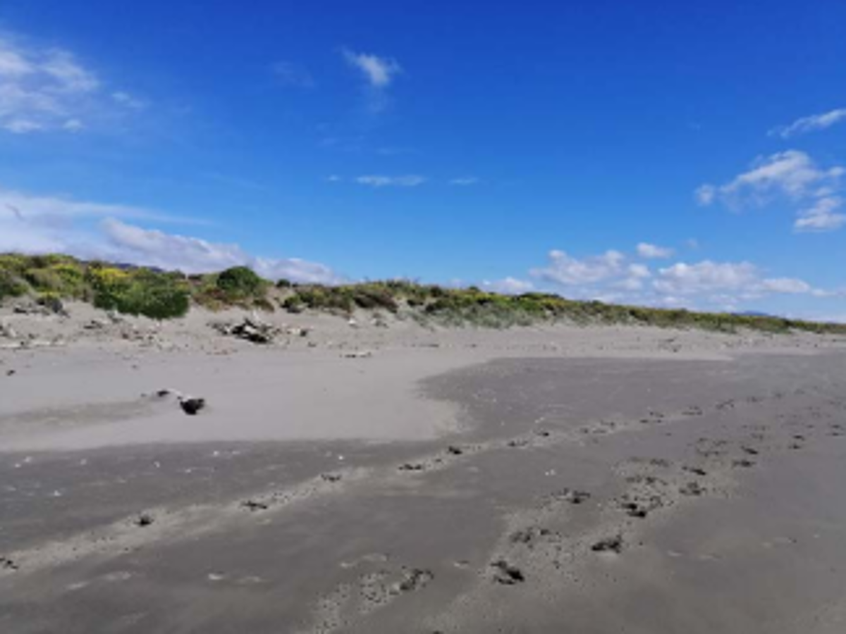 A. Peka Peka Beach and dunes.
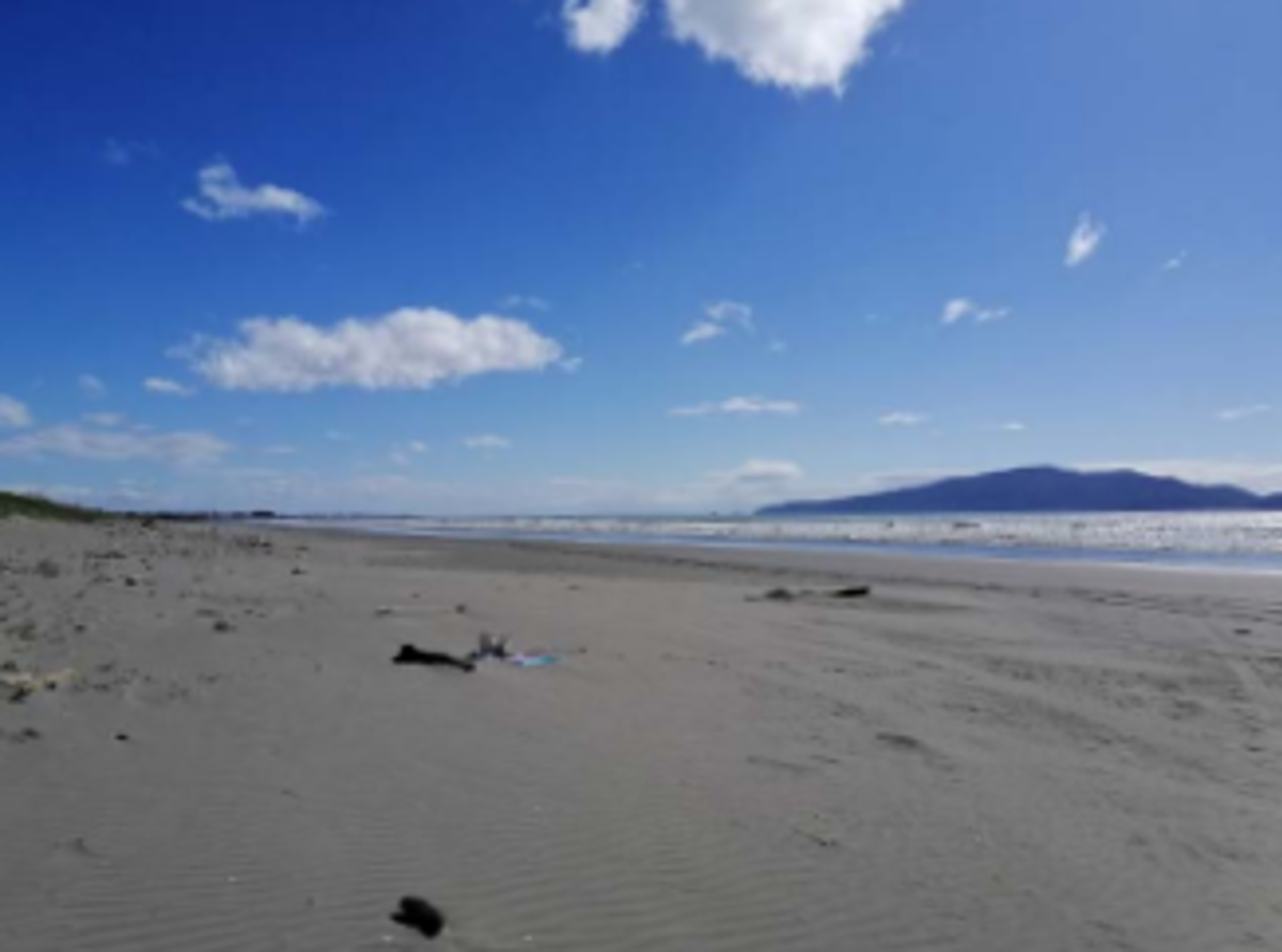 B. Peka Peka Beach and Kāpiti Island.
Key findings
- The Peka Peka shoreline has a good sediment supply that has resulted in historical shoreline growth in the past.
- If this trend continues, only a small amount of erosion associated with extremely large storms is projected to occur under low relative sea level rise (RSLR) scenarios over the next 30, 50, and 100 years. However, the shoreline is projected to erode under higher RSLR scenarios over the next 30–100 years.
- The Peka Peka settlement is currently not very susceptible to coastal flooding. However, with RSLR low-lying areas behind the dunes and in older dune swales become susceptible to flooding on both sides of Paetawa Road.
Future coastal erosion hazard
The shoreline at Peka Peka has a good sediment supply, which is projected to continue. As a result, it is projected that for the next 100 years under the lower RSLR scenario, erosion is likely be limited to small distances (around the same as the present-day hazard) if an extremely large storm occurred near the end of the timeframe. However, under higher RSLR scenarios and over 100 years, the shoreline is projected to suffer greater erosion. The following erosion distances are averages from the upper bound of the ‘most likely’ erosion position.
Peka Peka
Projected to erode on average:
- 14m by 2050
- 16 to 24m by 2070
- 26 to 59m by 2130
Future coastal flood hazard
The dune ridge along the Peka Peka shoreline is generally higher than the storm tide water level in an extremely large storm, including RSLR and wave run-up, and therefore provides good protection for the settlement from coastal flood hazards. The main pathway for flooding inland is through Te Kowhai Stream.
0.35 m and 0.45 m RSLR (~2070)
The susceptibility to flooding increases in the dune swales that run parallel to the coastline either side of Paetawa Road. The area susceptible to flooding around Te Kowhai Stream increases in size and land around the open drain south of Peka Peka Road starts to become susceptible.
0.85m and 1.25m RSLR (~2130)
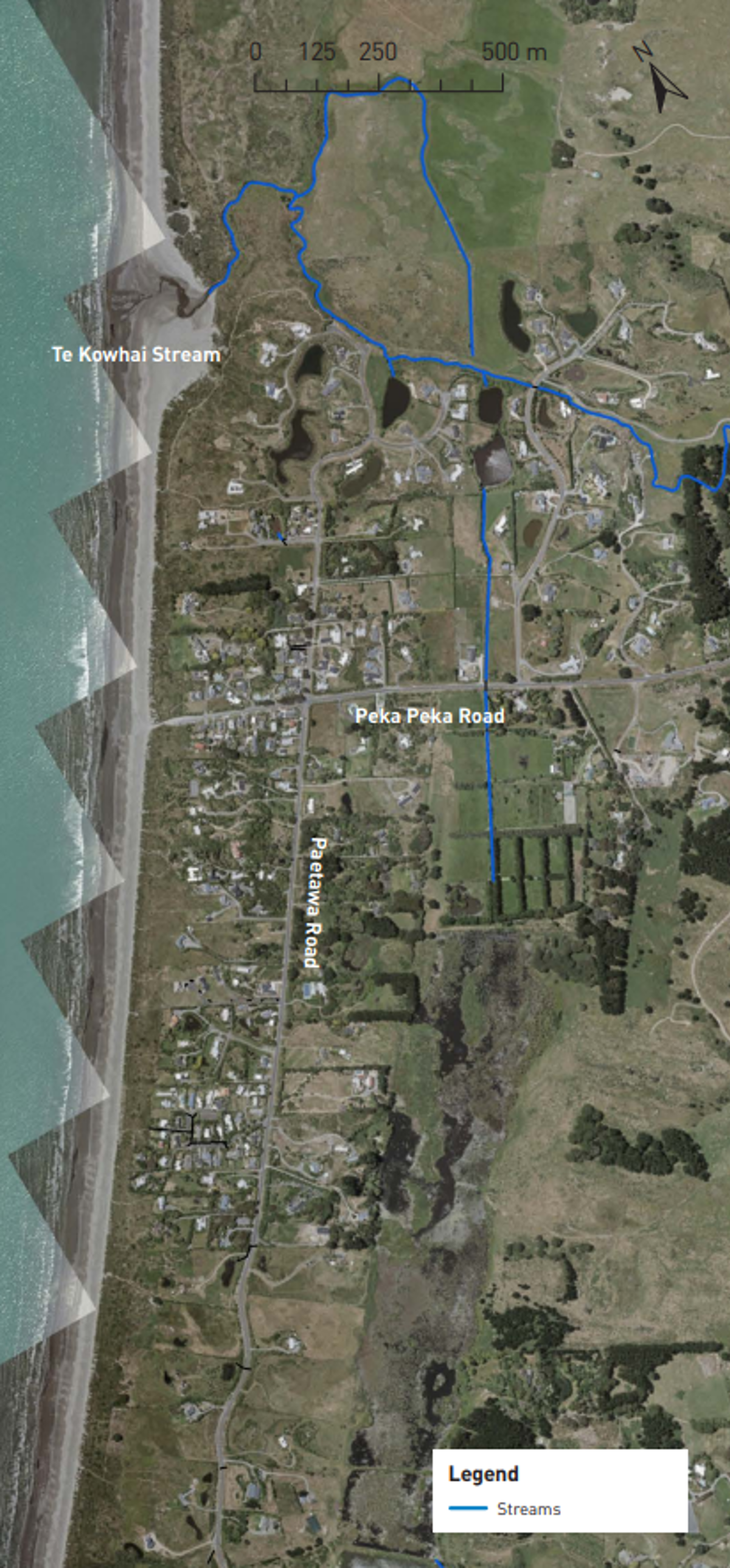
Under the higher RSLR scenario, the southern end of the settlement in the lower dune swale area becomes more susceptible to flooding, as well as a significantly larger area of land behind the settlement.
Asset exposure
For coastal erosion, stormwater outlets could be affected by erosion by 2050. For private land parcels, no properties are projected to be affected until 2130, where up to 9–33 land parcels along the beach front could become susceptible to erosion.
For flooding, an increasing number of private properties in the Peka Peka settlement become susceptible to flooding in extremely large storms with RSLR. 131-145 properties could be exposed to flooding over the next 50 years, increasing to 171-206 properties by 2130. The main evacuation route, Peka Peka Road, is not susceptible to coastal inundation in any of the RSLR scenarios considered.
How these hazards have been assessed for Peka Peka
Coastal science experts from Jacobs assessed the susceptibility of coastal erosion and flooding hazards and the exposure or vulnerability of land parcels and infrastructure (eg, roads, bridges, three water assets) to these hazards across the entire Kāpiti District.
Government guidance recommends that for detailed hazard and risk assessment in both coastal and non-coastal areas, councils should assess the SSP2-4.5 ‘middle of the road’ climate change scenario, and higher SSP5-8.5 ‘fossil fuel intensive’ climate change scenario.
Coastal erosion
The components used to calculate a potential coastal erosion distance along the Peka Peka coastline include:
- the natural long-term trend of the shoreline movement (i.e. eroding, growing, or stable)
- the amount of erosion which could occur as a direct result of the rise in sea levels compared to land level (termed the Relative Sea Level Rise (RSLR)) over time frames of 30, 50, and 100 years
- short-term storm erosion from an extremely large storm which has approximately a 1% chance of occurring in each year, based on observations from the September 1976 storm, and erosion from dunes restabilising to their natural stable slope following a large storm.
Jacobs used a ‘probabilistic approach’ to tie likelihoods to the erosion distances calculated for each scenario of RSLR. The ‘most likely’ range of shoreline positions has a 33–66% chance of occurring. The ‘unlikely’ shoreline position is where there is a 10% chance that the erosion would reach or be greater than this position.
Coastal flooding
To assess the coastal flood hazard for Peka Peka Jacobs mapped the area which is susceptible to flooding by a large storm tide which has a 1% chance of occurring in any year. The maps show the flooding that could occur at the present time and in the future, for RSLR scenarios of +0.2m; +0.35m; +0.45m; +0.85m; and +1.25m. Jacobs used a simple ‘bathtub’ approach, where all land below the storm tide water level is mapped as susceptible to flooding, regardless of connection to the sea. The maps also show areas which could be affected by additional flooding due to wave run-up overtopping the dunes.
- Peka Peka Coastal Hazards factsheet [PDF 579 KB]