Te Horo coastal hazards
Te Horo coastal environment
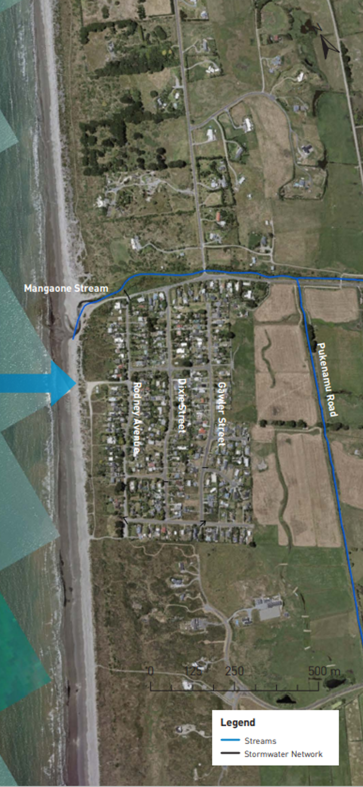
The open coast at Te Horo Beach is a composite (sand and gravel) beach with a low gravel ridge behind the beach. Sand is supplied to this area by the persistent southward longshore transport of sediments from the four large rivers to the north (Whanganui, Whangaehu, Rangitikei and Manawatū rivers), and the gravel is supplied by the Ōtaki River. The supply rate is greater than the transport losses to the south, resulting in long-term shoreline growth. Mangaone Stream at the northern end of the beach settlement is the main pathway for coastal flooding of the settlement.
Present-day erosion and flood hazards
The present-day erosion hazard is what could occur in an extremely large storm (which has a 1% chance of occurring each year in the immediate/ near future). At Te Horo Beach, this is ‘most likely’ to be 9 to 11m of erosion, and ‘unlikely’ to be more than 13m.
The area most susceptible to flooding in a very large storm is the Mangaone Stream mouth and the low-lying area around it. A small number of properties at the northern end of the settlement are potentially susceptible to flooding through the road drain at the northern end of Rodney Avenue.
Key findings
- The coastline at Te Horo Beach has a good sediment supply that has historically resulted in shoreline growth.
- If this trend continues, only a small amount of erosion is projected to occur under low relative sea level rise (RSLR) scenarios associated with extremely large storms. However, the shoreline is projected to erode under higher RSLR scenarios over the next 50–100 years.
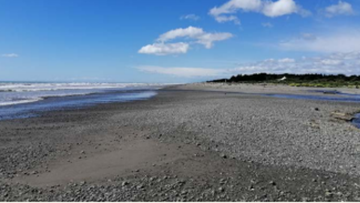) A. Composite beach at Te Horo, looking north.
A. Composite beach at Te Horo, looking north.
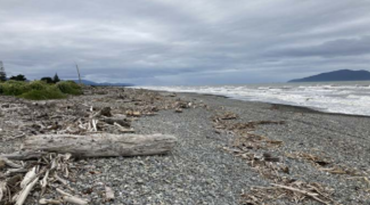) B. Composite beach at Te Horo, looking south.
B. Composite beach at Te Horo, looking south.
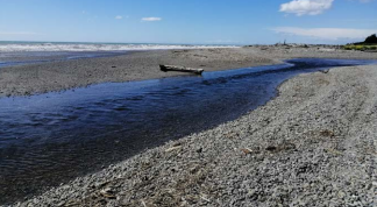) C. Mangaone Stream
C. Mangaone Stream
- For coastal flooding, Te Horo Beach settlement is protected by a low gravel ridge but is susceptible to flooding through a pathway up the Mangaone Stream and from wave overtopping.
- Under higher RSLR scenarios, properties within the settlement become susceptible to coastal flooding, as well as low-lying farmland behind the settlement and the main evacuation route out of Te Horo Beach.
Future coastal erosion hazard
The shoreline at Te Horo Beach has good sediment supply which is projected to continue. As a result, it is projected that over the next 50 years, this will continue and any erosion is likely be limited to small distances (less than the present-day hazard) if an extremely large storm occurred near the end of the timeframe. However, over 100 years the shoreline is projected to erode. The following erosion distances are averages from the upper bound of the ‘most likely’ erosion position.
Te Horo Beach
The shoreline is projected to:
- By 2050, erode by an average of 2m
- By 2070, grow by an average of 4m under the lower RSLR scenario, but erode by 30m under the higher RSLR scenario
- By 2130, grow by an average of 17m under the lower RSLR scenario, but erode by an average of 17m with 1.25m RSLR.
Future coastal flood hazard
0.35m and 0.45m RSLR (~2070)
There is an increase in the area flooded around the mouth of Mangaone Stream, with Rodney Avenue and some properties around this road becoming potentially vulnerable from direct inundation and wave overtopping. Farmland behind the settlement between Sims Road and Harakeke Road becomes vulnerable to flooding.
0.85m and 1.25m RSLR (~2130)
There is an increase in the area flooded which is directly connected to the sea. Flooding that occurs along Rodney Ave has the potential to worsen with additional flooding caused from waves overtopping the beach. There are extensive areas of susceptible land behind the settlement up to Pukenamu Road. Many properties around Dixie Street and Gawler Street are not mapped to become flooded, however the main evacuation route out of the settlement is vulnerable to flooding.
)
Asset exposure
For coastal erosion, no council infrastructure was mapped as being vulnerable to coastal erosion in the future. Up to 14 private properties located close to and around the Mangaone Stream could be vulnerable to coastal erosion over the next 30 years if the position of the stream migrates to where it has historically been.
The number of properties potentially affected by flooding increases with RSLR. Te Horo Beach Road starts to become susceptible to flooding in extremely large storms with 0.35m RSLR (50 years’ time).
How these hazards have been assessed for Te Horo
Coastal science experts from Jacobs assessed the susceptibility of coastal erosion and flooding hazards and the exposure or vulnerability of land parcels and infrastructure (eg, roads, bridges, three water assets) to these hazards across the entire Kāpiti District.
Government guidance recommends that for detailed hazard and risk assessment in both coastal and non-coastal areas, councils should assess the SSP2-4.5 ‘middle of the road’ climate change scenario, and higher SSP5-8.5 ‘fossil fuel intensive’ climate change scenario.
Coastal erosion
The components used to calculate a potential coastal erosion distance along the Te Horo Beach coastline include:
- the natural long-term trend of the shoreline movement (i.e. eroding, growing, or stable)
- the amount of erosion which could occur as a direct result of the rise in sea levels compared to land level (termed the Relative Sea Level Rise (RSLR)) over time frames of 30, 50, and 100 years
- short-term storm erosion from an extremely large storm which has approximately a 1% chance of occurring in each year, based on observations from the September 1976 storm.
Jacobs used a ‘probabilistic approach’ to tie likelihoods to the erosion distances calculated for each scenario of RSLR. The ‘most likely’ range of shoreline positions has a 33–66% chance of occurring. The ‘unlikely’ shoreline position is where there is a 10% chance that the erosion would reach or be greater than this position.
Coastal flooding
To assess the coastal flood hazard for Te Horo Beach Jacobs mapped the area which is susceptible to flooding by a large storm tide which has a 1% chance of occurring in any year. The maps show the flooding that could occur at the present time and in the future, for RSLR scenarios of +0.2m; +0.35m; +0.45m; +0.85m; and +1.25m. Jacobs used a simple ‘bathtub’ approach, where all land below the storm tide water level is mapped as susceptible to flooding, regardless of connection to the sea. The maps also show areas which could be affected by additional flooding due to wave run-up overtopping the beach system.
- Te Horo Coastal Hazards factsheet [PDF 945 KB]