Waikanae coastal hazards
Waikanae coastal environment
The Waikanae coastline consists of a flat sandy beach backed by vegetated dunes which provides good natural protection for houses from the effects of coastal erosion and flooding. Waikanae Beach is at the northern end of the wave shadow created by Kāpiti Island. Sand is supplied to this area by persistent southward longshore transport of sediments from the four large rivers to the north (Whanganui, Whangaehu, Rangitikei and Manawatū rivers). The supply rate is greater than the transport losses to the south, resulting in long-term shoreline growth.
Present-day erosion and flood hazards
The present-day erosion hazard is what could occur in an extremely large storm (which has a 1% chance of occurring each year in the immediate/ near future). In Waikanae there is ‘most likely’ to be up to 8–9m of erosion along the shoreline between Waimeha stream and Waikanae Estuary; and 12–14m along the shoreline north of Waimeha Stream.
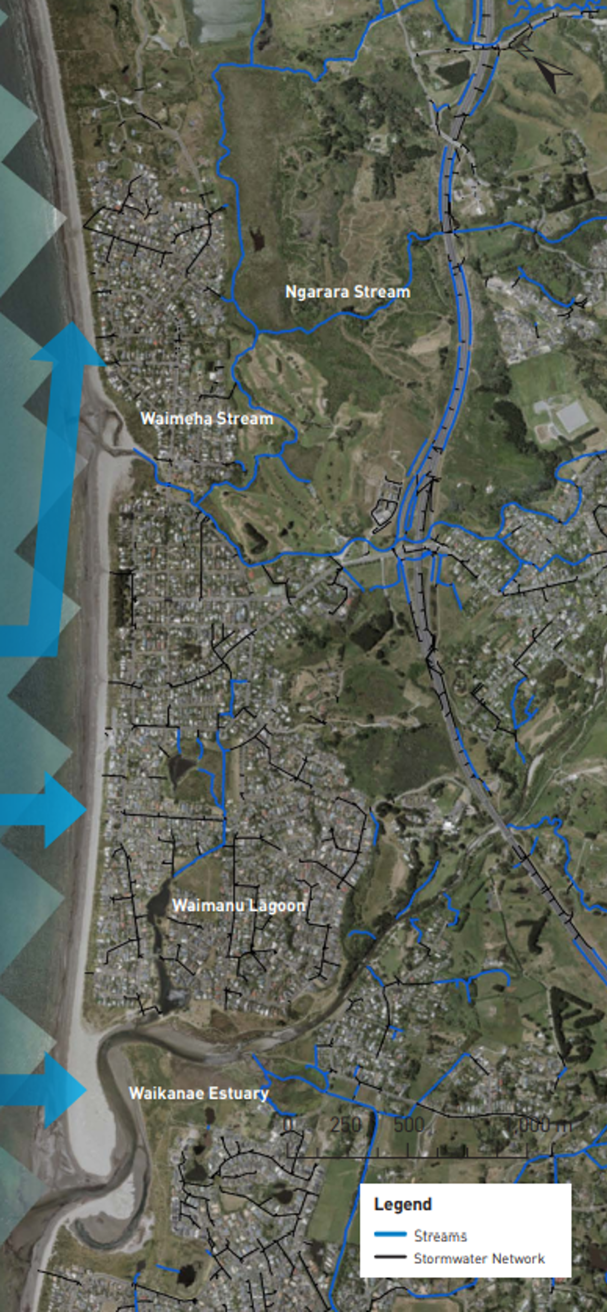
At Waikanae Beach, the areas susceptible to coastal flooding in the same sized storm are alongside the Waimeha and Ngarara Streams, and around the edges of the Waimanu Lagoon. The causeway and outlet structure at the Waimanu Lagoon protects the lagoon and drainage network inland of the lagoon from inundation but there is a residual susceptibility to flooding if the control structure fails.
Key findings
- The Waikanae shoreline has a good sediment supply that has resulted in historical shoreline growth in the past.
- If this trend continues, only a small amount of erosion (10m) is projected to occur over the next 30 years, which will be associated with extremely large storms. However, the shoreline is projected to erode under higher RSLR scenarios over the next 50–100 years.
- Waikanae Beach is susceptible to flooding from storm tides through the Waikanae Estuary and Waimeha Stream which provide pathways for flooding from the sea.
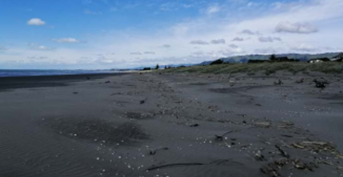 A. Wide sandy beach with dunes fronting Waikanae Beach north of the estuary.
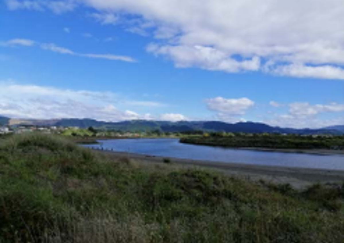
 B. Waikanae Estuary
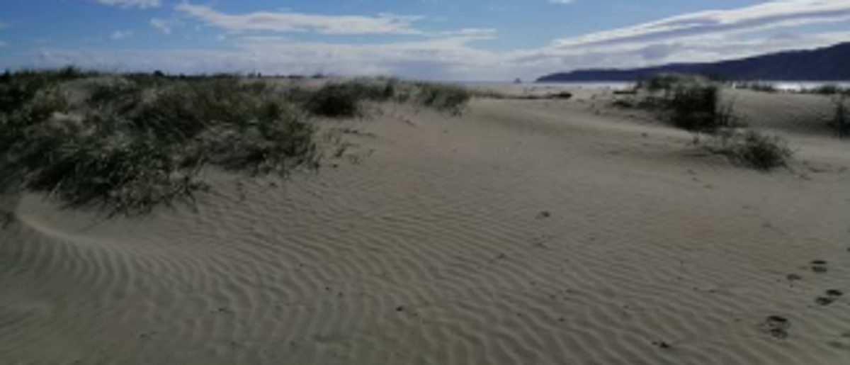 C. Low vegetated dunes near Waikanae estuary.
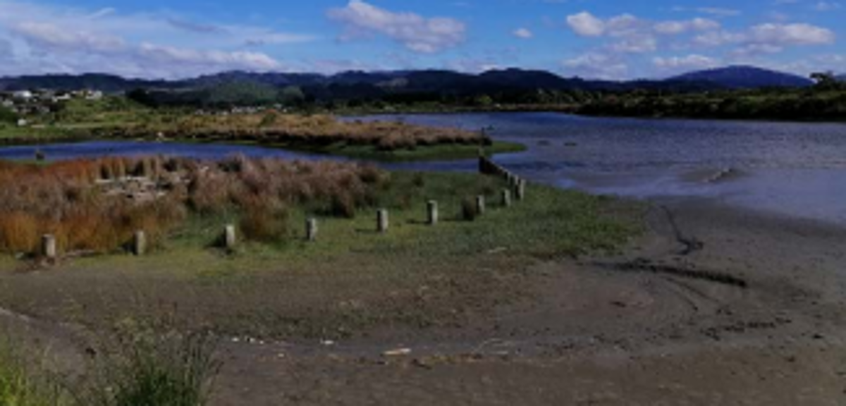
 D. Waikanae estuary
- Under current conditions, flooding in an extreme tide event is localised to drains, streams and lagoons, but with future RSLR the area susceptible to coastal flooding will increase, becoming extensive in the highest RSLR scenario considered.
Future coastal erosion hazard
The Waikanae shoreline has a good sediment supply which is projected to continue. As a result it is projected that under the lower RSLR scenarios for each timeframe shoreline growth will continue and that any erosion is likely be limited to small distances (less than the present-day hazard) if an extremely large storm occurred near the end of the timeframe. However, under higher RSLR scenarios at 30, 50 and 100 years, the shoreline is projected to erode. The following erosion distances are averages from the upper bound of the ‘most likely’ erosion position.
North of Waimeha Stream
Projected to erode on average:
- 9m by 2050
- 10m to 2m by 2070
- 15 to 31m by 2130
South of Waimeha Stream
Projected to erode on average:
- 6m by 2050
- 4 to 11m by 2070
- 4 to 30m by 2130
Future coastal flood hazard
Key flooding pathways at Waikanae Beach are through the Waimeha Stream and Waikanae Estuary, and the streams and stormwater network that flow into them (Ngarara Stream and Waimanu Lagoon).
0.35m and 0.45m RSLR (~2070)
The susceptible area around Ngarara Stream increases with these RSLR scenarios. Land around several streets set back from the coastline become susceptible to flooding (Titoki Rd, Tutere St, Hona St and Hemara St). The Waimanu lagoon and the surrounding land become susceptible to direct flooding from the Waikanae Estuary through overtopping of the Waimanu causeway.
0.85m and 1.25m RSLR (~2130)
The area around Field Way and Hughes Street are susceptible to inundation through stormwater outfalls. South of Waimeha Stream, much of the area is susceptible to direct flooding from the Waimeha Stream and Waikanae Estuary, through the Waimanu Lagoon.
Asset exposure
Coastal stormwater outlets are the only Council infrastructure identified as vulnerable to coastal erosion in Waikanae. Up to 107 private properties could be exposed to coastal erosion under the higher SSP5-8.5 scenario over the next 100 years.
For coastal flooding, the key evacuation route, Te Moana Road, becomes increasingly susceptible to inundation in extremely large storms along with RSLR.
How these hazards have been assessed for Waikanae Beach
Coastal science experts from Jacobs assessed the susceptibility of coastal erosion and flooding hazards and the exposure or vulnerability of land parcels and infrastructure (eg, roads, bridges, three water assets) to these hazards across the entire Kāpiti District.
Government guidance recommends that for detailed hazard and risk assessment in both coastal and non-coastal areas, councils should assess the SSP2-4.5 ‘middle of the road’ climate change scenario, and higher SSP5-8.5 ‘fossil fuel intensive’ climate change scenario.
Coastal erosion
The components used to calculate a potential coastal erosion distance along the Waikanae Beach coastline include:
- the natural long-term trend of the shoreline movement (i.e. eroding, growing, or stable)
- the amount of erosion which could occur as a direct result of the rise in sea levels compared to land level (termed the Relative Sea Level Rise (RSLR)) over time frames of 30, 50, and 100 years
- short-term storm erosion from an extremely large storm which has approximately a 1% chance of occurring in each year, based on observations from the September 1976 storm, and erosion from dunes restabilising to their natural stable slope following a large storm.
Jacobs used a ‘probabilistic approach’ to tie likelihoods to the erosion distances calculated for each scenario of RSLR. The ‘most likely’ range of shoreline positions has a 33–66% chance of occurring. The ‘unlikely’ shoreline position is where there is a 10% chance that the erosion would reach or be greater than this position.
Coastal flooding
To assess the coastal flood hazard for Waikanae Beach, Jacobs mapped the area which is susceptible to flooding by a large storm tide which has a 1% chance of occurring in any year. The maps show the flooding that could occur at the present time and in the future, for RSLR scenarios of +0.2 m; +0.35 m; +0.45 m; +0.85m; and +1.25m. Jacobs used a simple ‘bathtub’ approach, where all land below the storm tide water level is mapped as susceptible to flooding, regardless of connection to the sea. The maps also show areas which could be affected by additional flooding due to wave run-up overtopping the dunes.
- Waikanae Coastal Hazards factsheet [PDF 692 KB]